
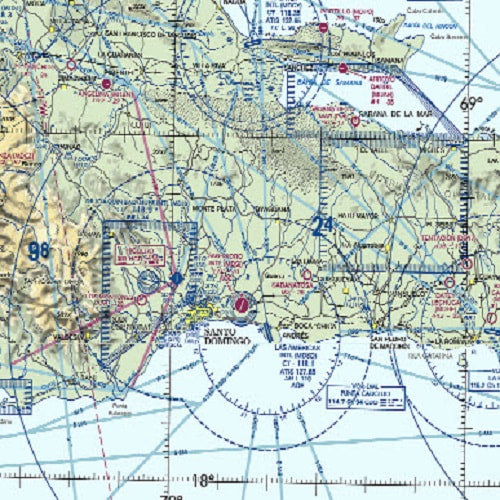


Caribbean VFR Aeronautical Chart 2 (CAC-2) is designed for visual navigation to assist familiarization of foreign aeronautical and topographic information. The aeronautical information includes visual and radio aids to navigation, airports, controlled airspace, special-use airspace, obstructions, and related data. The topographic information consists of contour lines, shaded relief, drainage patterns, and a selection of landmarks used for flight under VFR. Cultural features include cities and towns, roads, railroads, and other distinct landmarks. CAC-2, revised is revised every 56 days and consists of two sides measuring 20" x 60" each.
Decsription
Caribbean VFR Aeronautical Chart 2 (CAC-2) is designed for visual navigation to assist familiarization of foreign aeronautical and topographic information. The aeronautical information includes visual and radio aids to navigation, airports, controlled airspace, special-use airspace, obstructions, and related data. The topographic information consists of contour lines, shaded relief, drainage patterns, and a selection of landmarks used for flight under VFR. Cultural features include cities and towns, roads, railroads, and other distinct landmarks. CAC-2, revised is revised every 56 days and consists of two sides measuring 20" x 60" each.
Reviews